We have a transport strategy in place that shows the vision for Barnsley by 2033. The strategy demonstrates that by 2033 Barnsley will have:
- enhanced connectivity to the international airports and ports serving the city regions.
- improved connections between Barnsley, the city regions and other economic centres, especially Leeds, Manchester and London.
- a transport system that will meet the needs of businesses to access markets and their supply chains.
- well-connected employment, recreation, social and housing locations.
- connections to high-speed rail and the regional transport hubs.
- targeted improvements that enable our road network to perform in the most effective way.
To achieve the strategy, we've secured money from various funds which has helped us to develop and deliver transport projects across the borough. You can find out about schemes we’ve completed or are currently working on below.
Current projects
Town centre to Oakwell active travel scheme
Project overview
Project status: In delivery
We're looking to introduce walking and cycling improvements to the Kendray Street area. The proposals are aimed at improving the provision for walking and cycling. These will take place between the interchange and the Barnsley Metrodome and Oakwell Stadium.
The scheme aims to deliver key active travel improvements to Kendray Street and Pontefract Road. These are beneath Harborough Hill Road. The aim is to better connect the town centre with Oakwell and the areas around it.
It will be funded by the Mayoral Legacy Fund and is delivered in partnership with the South Yorkshire Mayoral Combined Authority (SYMCA).
Please see below for more details and plans of the scheme.
Proposals
The scheme aims to improve the active travel offering by doing the following:
- Toucan crossing over Kendray Street, at the foot of the new Market Gate Bridge
- Footway widening along Kendray Street, up the slip road onto Harborough Hills Road and into Pontefract Road
- Reclassification of footways to shared use, permitting cycling
- Signage/wayfinding from Kendray Street to Metrodome and Oakwell
- Amendments to Southbound exit slip road across junction with Queens Road
- Revised traffic signal arrangements
- New access arrangements to bingo hall subject to approval
- Higher standard of paving and public realm features
Project timeline
| Milestone | Provisional date |
| Final funding approval | November 2024 |
| Construction start | January 2025 |
| Construction end | July 2025 |
Plans
View the town centre to Oakwell active travel scheme plan.
Worsbrough to Wombwell TPT scheme
Project overview
Project status: In delivery
We, along with the South Yorkshire Mayoral Combined Authority (SYMCA) and their partners are proposing to upgrade and resurface sections of the Trans-Pennine Trail (TPT) between Worsbrough and Wombwell.
The project is part of the City Region Sustainable Transport Settlement (CRSTS) supported by the South Yorkshire Mayoral Combined Authority (SYMCA) and central government for the creation of new and upgraded active travel links to increase walking and cycling in the borough and reduce reliance on car-based journeys.
We've committed to upgrading many areas of the network to improve the attractiveness of the active travel routes in the borough. This scheme is part of this commitment, seeking to improve the key strategic route between Worsbrough and Wombwell along the TPT.
Some of the benefits the scheme aims to deliver include:
- Improved off-road safe cycle routes;
- Greater linked routes and wider connections;
- Enhanced connections to residential areas;
- Better signage to active travel routes;
- Improved road crossing provision
Proposals
This scheme proposes to resurface and widen sections of the existing TPT route between Park Road, Worsbrough and Bradberry Balk Lane, Wombwell. In most areas, the scheme will provide a 4m wide route comprising of a 2m tarmac strip besides a 2m crushed stone strip, as to benefit all users. This will improve the quality and capacity of the route and help bring it into compliance with modern active travel route guidance.
The scheme also proposes upgrades and improvements to the road crossings along the route to improve the accessibility and inclusivity of the Trans Pennine Trail.
Projected timeline
The table below shows the proposed key milestones that we’re working towards for this project.
| Activity | Date |
| Scheme consultation and development | September 2024 |
| Construction start | November 2024 |
| Construction end | March 2025 |
Plans
Details and plans for this scheme are outlined in the link below.
Bike Works Active Travel Hub
Project overview
Project status: In delivery
We, along with the South Yorkshire Mayoral Combined Authority (SYMCA) and their partners are proposing to transform the existing Active Travel Hub site at the Transport Interchange on Eldon Street into the Barnsley Bike Works headquarters.
The site will be expanded, have more secure bike parking spaces, improved shower and toilet facilities and a brand-new loan fleet of conventional bikes and electric bikes. This is thanks to money from the South Yorkshire Mayoral Combined Authority’s City Region Sustainable Transport Settlement fund, which seeks to increase walking and cycling in the borough and reduce reliance on car-based journeys.
Projected timeline
The table below shows the proposed key milestones that we’re working towards for this project.
| Activity | Date |
| Construction start | November 2024 |
| Construction end | April 2025 |
Darton active travel route
Project overview
Status: In development
The project is part of the City Region Sustainable Transport Settlement (CRSTS) supported by the South Yorkshire Mayoral Combined Authority (SYMCA) and central government. It will create new and upgraded active travel links in the borough to increase walking and cycling and reduce reliance on car-based journeys.
We've committed to upgrading many areas of the network to improve the attractiveness of the active travel routes in the borough. This scheme will contribute to the growing active travel network by connecting Mapplewell and Darton with the recently delivered A61 Royston to Town Centre Active Travel Scheme.
Some of the benefits the scheme aims to deliver include:
- Improved off-road safe cycle routes.
- Greater linked routes and wider connections.
- Enhanced connections to a local school and residential areas.
- Better signage to active travel routes.
- Improved road crossing provision.
Proposals
The scheme aims to deliver active travel improvements between the areas of Bar Lane, Mapplewell, and Darton Primary School. The primary focus of the scheme is the widening and resurfacing of an existing trail that connects Darton Primary School with Spark Lane, so that it can be used more easily and safely and at all times of year.
The project team are still investigating how best to connect Spark Lane with Bar Lane and are considering options along Carr Green Lane and Hill End Road.
Projected timeline
The table below shows the proposed key milestones that we're currently working towards. These are subject to change.
| Activity | Date |
| Submission of final business case | TBC |
| Construction start | June 2025 |
| Construction end | December 2025 |
Consultation
This scheme was presented to the public in November 2022 through drop-in events and communicated via letters and social media. The feedback from this consultation period is under consideration as the scheme develops. Before this scheme is delivered, another period of engagement will be held to pass on information on the fixed proposals.
Plans
Updated plans for this scheme will be published here following completion of our next design stage.
A635 Stairfoot quality bus corridor
Project overview
Status: In development
The A635 Stairfoot quality bus corridor is a bus rapid transit (BRT) scheme. It proposes to redesign and increase the size of Stairfoot roundabout and many of its entry and exit lanes. The scheme aims to support regeneration by reducing current and forecasted congestion along the A635 Doncaster Road corridor. It also aims to improve bus services and journey times and improve pedestrian and cycling facilities to encourage more people to get out and travel active.
The project is part of the City Region Sustainable Transport Settlement (CRSTS) supported by the South Yorkshire Mayoral Combined Authority (SYMCA) and central government.
Currently this scheme is in the development stage and the proposals may change we progress through the design stages.
Proposals
This scheme proposes to:
- Straighten the approach to the roundabout from Wombwell lane/Bleachcroft Way.
- Replace the bus lane on Doncaster Road which enters the roundabout with an extra all vehicle lane.
- Increase the Grange Lane entry onto the roundabout from two lanes to three.
- Increase the Grange Lane exit off of the roundabout from one lane to two.
- Replace the bus lane on Bleachcroft Way with an all vehicle lane and a bus layby.
- Add another lane to the South-East section of the roundabout.
- Widen the pavement to a minimum of three meters and converted to shared use (foot and cycle).
- Improve the Trans Pennine Trail including replacing the bridge over Grange Lane.
Projected timeline
| Activity | Date |
| Submission of planning application | July 2025 |
| Submission of full business case (final funding approval) | TBC |
| Construction start | July 2026 |
| Construction end | TBC |
Frequently asked questions
Why do we need a larger roundabout?
Widening this roundabout will improve its overall capacity, reducing the time it takes during peak hours to travel through it. Reducing congestion across Barnsley's major travel corridors is vital to continued economic growth. Without intervention the current issue will continue to worsen.
Will there be any impact on flooding?
Through detailed drainage modelling work undertaken, the design of the BRT is such that surface water will be stored in drainage pipes under the swales at the side of the road and released in a controlled manner into the River Dearne. Working with landowners, we have a drainage solution that reduces the likelihood of flooding.
Where can I view the planning application for the BRT?
We aim to submit the planning application in July 2025. You will be able to view the planning application on the Council’s Planning web site. Notifications will be posted on lamp posts around the site at that time.
How is the scheme being funded?
The scheme has been funded through the South Yorkshire Mayoral Combined Authorities allocation of the City Region Sustainable Transport Settlement.
Will we use compulsory purchase orders to acquire the land?
Whilst we don’t foresee the need to use CPO powers, the Council could pursue this if necessary. We are currently negotiating with landowners for a mutual resolution.
How will this affect wildlife and trees?
Despite this area already being largely urbanised with very little green space we have undertaken a number of ecological surveys and have mitigation measures in place. We also have a comprehensive tree planting and landscape scheme, which includes a 10:1 replacement of any trees that are affected, as well a commitment to a biological net gain.
Contact us
For more details about this transport scheme, or to give feedback, please contact us. You can do so by emailing stairfootbrt@barnsley.gov.uk.
A628 Cundy Cross improvement scheme
Project overview
The A628 Cundy Cross improvement scheme proposes to reconfigure Cundy Cross junction and several of its entry and exit lanes. The scheme aims to support regeneration by relieving current and forecasted congestion along the A628 Pontefract Road corridor as well as improving bus journey time reliability.
This project forms part of our City Region Sustainable Transport Settlement (CRSTS) programme and is supported by the South Yorkshire Mayoral Combined Authority (SYMCA) and central government.
Proposals
The scheme proposes:
- improvement of existing traffic lanes to create a more efficient junction
- removal of current pedestrian refuge island on Pontefract Road near Priory Campus to create a longer two-lane inbound approach, reducing vehicle queues
- relocation of inbound bus stop on Pontefract Road back towards Littleworth Lane junction to be closer to existing signal-controlled crossing
- removal of traffic signals at Rotherham Road and Meadow View junction
- closure of Lang Avenue to vehicular traffic at its junction with Pontefract Road, improving footway connectivity and the flow of traffic on Pontefract Road
- extension of two-lane approach on Grange Lane to reduce vehicle queue lengths and improve junction efficiency
Projected timeline
| Item | Provisional date |
| Submission of business case | April 2025 |
| Construction start | June/July 2025 |
| Construction end | November 2025 |
Plans
View a plan of the proposed works.
Consultation
The consultation period will run for two weeks from Monday 24 February to Sunday 9 March.
Within this period, you can provide feedback to these proposals in several ways. We're holding two drop-in consultation sessions to give you the chance to view our plans and provide in-person feedback.
Drop-in events
| Date | Venue | Time |
| Tuesday 4 March | Maple Room, BHF Priory Centre, Pontefract Road, Lundwood, Barnsley, South Yorkshire, S71 5PN | 1pm to 5pm |
| Thursday 6 March | Maple Room, BHF Priory Centre, Pontefract Road, Lundwood, Barnsley, South Yorkshire, S71 5PN | 10am to 2pm |
Online survey
We encourage everyone to give feedback via our online survey so you can give your views.
Contact us
For any further details regarding this transport scheme, or to provide feedback, please contact us. You can do so by emailing transportation@barnsley.gov.uk.
Completed projects
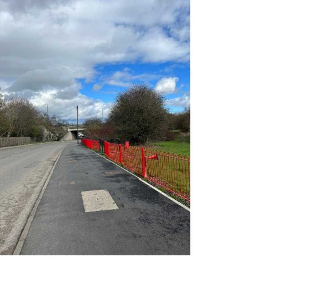
Goldthorpe station access scheme
Delivered in 2022
The scheme delivered improved active travel connectivity to Goldthorpe train station from Thurnscoe and Goldthorpe. Footways and crossing points along Nicholas Lane, Thurnscoe Bridge Lane and Shepherd Lane were widened, improved and upgraded to shared use, for the use of cycles as well as walking.
The route benefits Thurnscoe residents who access Highgate Primary School in Goldthorpe, making it safer and more enjoyable to travel actively.
In the first year, the route saw a 17% increase in usage.
The scheme was funded via the Active Travel Fund tranche 2, from central government, and delivered in partnership with the South Yorkshire Mayoral Combined Authority (SYMCA).
Elsecar active travel scheme
Delivered in 2022
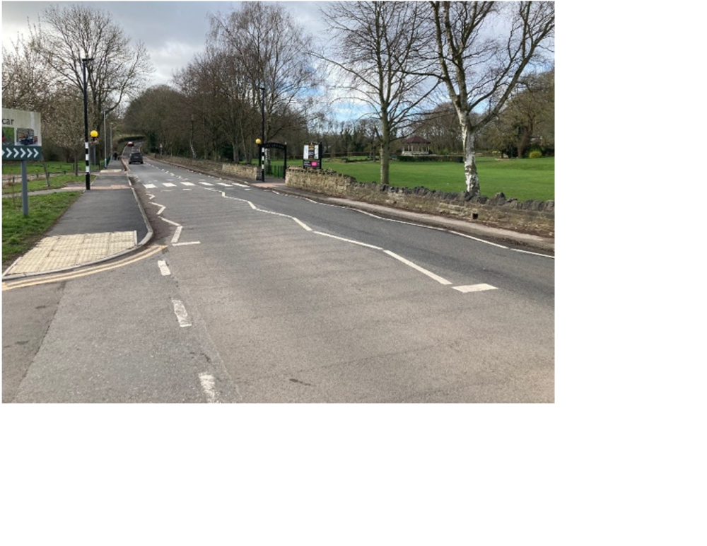
The scheme was a package of measures put together to improve walking and cycling connectivity between Elsecar Heritage Centre and Cortonwood Retail Park.
The schemes primary aim was to widen and resurface 3.2km of existing public right of way and Trans Pennine Trail between the two destinations. This was to make it safer, easier and more enjoyable to travel actively.
As well as the route improvements we added wayfinding signage, additional seating and made improvements to the crossing point. We also added route finders which showcase Elsecar Heritage Centre attractions.
The scheme delivered a new zebra crossing on Wentworth Road making it easier for pedestrians to cross safely between the Heritage Centre and Elsecar Park. An extended 30mph speed limit was also introduced onto Wentworth road to improve pedestrian safety in Elsecar.
In the first year, the route saw a 33% increase in usage.
This scheme was funded via the Active Travel Fund tranche 2, from central government, and delivered in partnership with the South Yorkshire Mayoral Combined Authority (SYMCA).
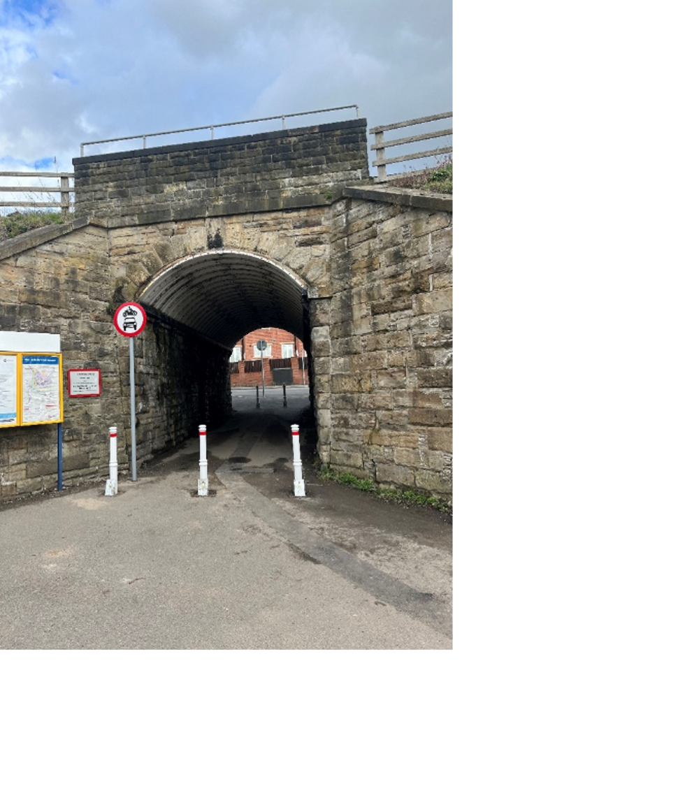
Darton station access scheme
Delivered in 2023
The scheme delivered a series of measures which aimed to improve safety and accessibility for pedestrians and cyclists around Darton train station.
The primary aim of the scheme was the prohibiting of vehicles through the underpass between Mill Lane and Station Road. Previously, the narrow width of the tunnel meant pedestrians and cyclists had to share the road with live traffic. Pedestrians and cyclists can now travel more safely through the underpass between platforms.
The scheme reduced any negative impact on vehicle movements by reconfiguring Mill Lane’s junction with Church Street.
Footways near to Darton train station were also widened and resurfaced to improve accessibility.
This scheme was funded via the Transforming Cities Fund, from central government, and delivered in partnership with the South Yorkshire Mayoral Combined Authority (SYMCA).
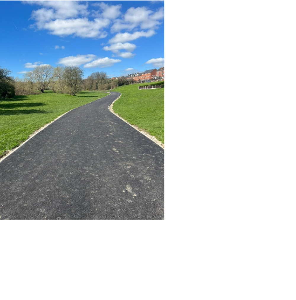
Elsecar station access scheme
Delivered in 2023
The scheme aimed to improve active travel connectivity between the station and the heritage centre.
From the station, heading south, footways along Fitzwilliam Street were widened. Cross points were improved and another crossing point was added. A new pedestrian and cycle track was constructed across the field between Fitzwilliam Street and the heritage centre off of Wath Road. The interventions will mean residents and visitors can travel between the two travel hotspots on a direct and all-weather active travel route.
This scheme was funded via the Transforming Cities Fund, from central government, and delivered in partnership with the South Yorkshire Mayoral Combined Authority (SYMCA).
A635 active travel scheme
Delivered in 2024
The scheme delivered 3.6km of active travel route improvements along the A635 Doncaster Road in Ardsley and Darfield. The scheme adds to existing infrastructure and makes it safer and more convenient to travel actively between Goldthorpe and Stairfoot.
The scheme was funded by the Transforming Cities Fund, from central government, and delivered in partnership with the South Yorkshire Mayoral Combined Authority (SYMCA).
The improvements the scheme delivered are as follows:
- Widening of footways along the A635 Doncaster Road within Ardsley and Darfield and upgraded to shared use.
- Three new multi-modal crossing points within the Ardsley addressing concerns with safety and severance.
- Prohibition of motor vehicles on a section of Fitzwilliam Road, Darfield, creating a dedicated active travel lane.
- One new multi-modal crossing point across the A6195 to connect the improved route with existing infrastructure.
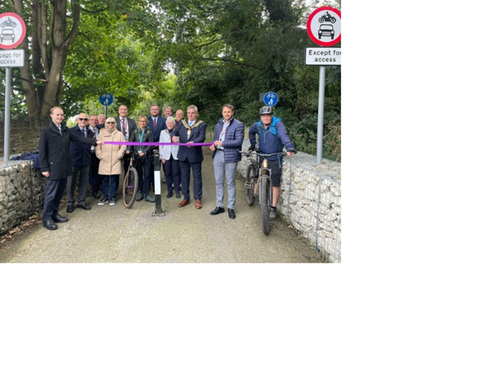
A61 Royston to town centre active travel scheme
Delivered in 2024
The scheme delivered 8.5km of improvements to sections of a continuous off-road active travel route between the town centre and Royston.
The aim of the scheme was to make it easier and encourage people to include active travel in all aspects of their lives. Better connected, more inclusive infrastructure is key in helping us achieve this goal.
The improvements the scheme delivered are as follows:
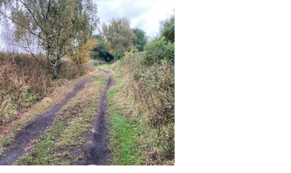
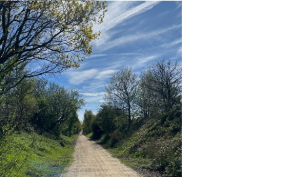
- Creation of a new 3m wide all-weather active travel track on the former rail line between Lee Lane, Royston, and Bar lane, Mapplewell, branching off around Athersley North.
- Creation of a new route off of Smithies Lane improving access to existing track around New Lodge connecting to Bar Lane, Mapplewell.
- Widening of footways along Smithies Lane.
- Crossing upgrades and footway widening from the A61 gyratory up Harborough Hill Road as far as Mottram Street.
This scheme was delivered under budget and the unspent money made sure components from other schemes which connect to the main works were also delivered.
The following improvements were delivered using the schemes underspend:
- Footway widening along Bar Lane, Mapplewell.
- Widening and resurfacing of the Trans Pennine Trail between Oakwell and Stairfoot.
- Widening and resurfacing of routes within the Dearne Valley Park between the A61 gyratory and Grange Lane.
The scheme was funded via the Transforming Cities Fund, from central government, and delivered in partnership with the South Yorkshire Mayoral Combined Authority (SYMCA).
The images show the Bar Lane, Mapplewell to Lee Lane, Royston section of the A61 active travel scheme before and after the scheme delivery.
Contact us
For any enquiries about our transport schemes contact us by emailing transportation@barnsley.gov.uk.
